中文
  • 繁體中文
  • 中文
  • عربي
  • አማርኛ
  • AzerbayjanlıName
  • БеларускаяName
  • Български
  • Polski
  • Bosanski
  • فارسی
  • Booleaanse (Afrikaans)
  • Dansk
  • Deutsch
  • Русский язык
  • Français
  • suomi
  • ჯორჯიანიName
  • pem
  • Nederlands
  • Кыргыз тили
  • Galiciano
  • Catalan
  • Čeština
  • Latina
  • Latvijas
  • Luganda
  • Ruwanda
  • română
  • Malti
  • বাংলা
  • Srpski@ item Spelling dictionary
  • Slovenská
  • slovenščina
  • Türkçe
  • Türkmençe
  • اوردو
  • УкраїнськаName
  • o'zbek
  • Español
  • Ελληνικά
  • Italiano
  • English
二维码
Scan and follow us
二维码

CCS Command and Control System for Low-altitude counter-UAV

热销

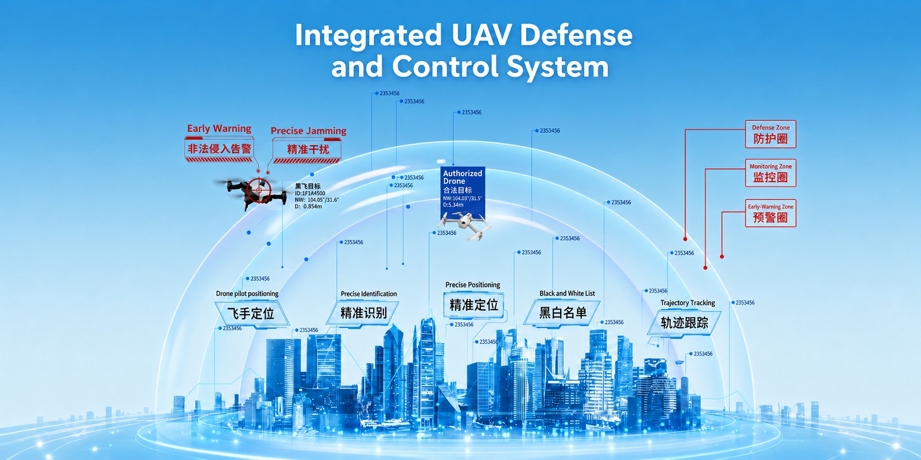
The CCS Command and Control System is a comprehensive, network - centric management platform designed for unmanned aerial vehicle (UAV) defense. It enables collaborative control across regions, unifies networking of multi - type counter - UAV devices (e.g., radars, jammers, cameras), and provides real - time monitoring, alerting, and intelligent data analysis. With a "One Network, One Map" architecture, it helps managers achieve cross - regional collaboration, unified command, and precise contro

价 格 待议

价 格 待议

CCS Command and Control System for Low-altitude counter-UAV

待议

选择规格数量

请勾选您要的商品信息!

产品详情

The CCS Command and Control System is a comprehensive, network - centric management platform designed for unmanned aerial vehicle (UAV) defense. It enables collaborative control across regions, unifies networking of multi - type counter - UAV devices (e.g., radars, jammers, cameras), and provides real - time monitoring, alerting, and intelligent data analysis. With a 'One Network, One Map' architecture, it helps managers achieve cross - regional collaboration, unified command, and precise control, effectively addressing unauthorized low - altitude drone intrusions and ensuring reliable security assurance.


Key Features:

  1. Unified Multi - Device Networking
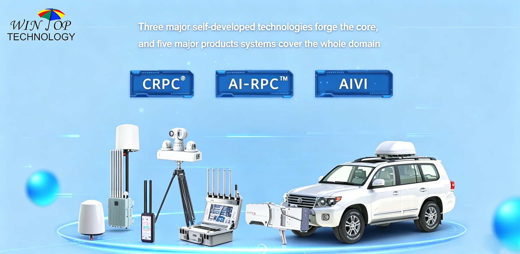
    Integrates radars, jammers, optoelectronic systems, and drones into a single network for seamless joint control.
  2. GIS Panoramic Visualization
    Displays real - time device status, UAV trajectories, and threat zones on an interactive GIS map for intuitive situational awareness.
  3. Real - Time Threat Alerting
    Sends instant notifications for unauthorized UAV intrusions, with customizable alert levels (critical/major/minor).
  4. AI - Driven Data Analysis
    Leverages AI to analyze UAV flight patterns, behaviors, and potential threats for proactive defense.
  5. Cross - Regional Collaboration
    Supports multi - level, cross - regional security management, enabling information sharing and coordinated responses.
  6. Flexible Permission Management
    Role - based access control ensures secure, granular permissions for different users (e.g., administrators, operators).
  7. Multi - Dimensional Display
    Presents data through maps, charts, and dashboards for comprehensive threat assessment.
  8. Efficient Decision - Making
    Provides real - time intelligence and automated reports to accelerate response and strategic planning.
  9. 24/7 Operation & Maintenance
    Robust monitoring tools ensure continuous system availability and minimal downtime.


WHY CHOOSE WINTOP

  • Expertise: 10 + years as a professional low - altitude security equipment manufacturer and exporter.
  • Compliance: Products meet FCC, CE, RoHS, and global aviation/security regulations.
  • Innovation: Patented 'One Network, One Map' architecture for seamless multi - device integration.
  • Support: 24/7 technical assistance, 2 - year global warranty, and on - site training.
  • Reliability: Trusted by 500 + clients (governments, police, airports) across 50 + countries.


20 FAQs (Customer - Centric)

  1. What is the CCS Command and Control System?
    A unified platform for managing, monitoring, and defending against unauthorized UAVs across regions.
  2. Which sectors need it?
    Airports, power grids, petrochemicals, government, prisons, border security, and major events.
  3. How does 'One Network, One Map' work?
    It integrates all devices (drones, radars, cameras) into a single network, visualized on one map for unified control.
  4. Can it manage third - party devices?
    Yes, it supports integration with most industry - standard security devices (radars, cameras, jammers).
  5. Is it suitable for large - scale deployments?
    Yes, multi - level organization management enables hierarchical control for enterprise - level security.
  6. Does it reduce false alarms?
    Yes, AI - driven filtering and whitelist management minimize false positives from authorized drones/objects.
  7. What’s the mobile experience like?
    The mobile app (iOS/Android) offers real - time alerts, map views, and remote control of connected devices.
  8. How secure is the platform?
    Role - based permissions, data encryption, and audit logs ensure only authorized personnel access sensitive information.
  9. Can it track multiple UAVs simultaneously?
    Yes, the platform supports real - time tracking of dozens of UAVs with detailed trajectory analysis.
  10. What kind of reports does it generate?
    Customizable reports on threat incidents, device performance, and response times for compliance/analysis.
  11. Is it cloud - based or on - premise?
    Both options are available (cloud - based for scalability, on - premise for maximum security).
  12. How long is the warranty?
    2 - year global warranty covering hardware, software, and technical support.
  13. Does it support AI - powered analytics?
    Yes, AI algorithms enhance threat detection, behavior analysis, and predictive monitoring.
  14. Can it integrate with existing security systems?
    Yes, APIs and SDKs enable seamless integration with legacy security infrastructure.
  15. What’s the typical deployment time?
    Standard deployments take 1–2 weeks (varies with device count and network complexity).
  16. Does it offer training for staff?
    Yes, on - site or remote training is provided to ensure your team masters the platform.
  17. Is 24/7 support available?
    Yes, our technical team provides round - the - clock assistance for emergencies.
  18. Can it be customized for specific needs?
    Yes, the platform is modular—we can tailor features (e.g., reporting, integrations) to your use case.
  19. Why choose WINTOP?
    Expertise, compliance, innovation, 24/7 support, and 500 + client references worldwide.
  20. How to request a demo?
    Contact our sales team via [website/email/phone] to schedule a personalized demo.


暂无评价

产品详情

The CCS Command and Control System is a comprehensive, network - centric management platform designed for unmanned aerial vehicle (UAV) defense. It enables collaborative control across regions, unifies networking of multi - type counter - UAV devices (e.g., radars, jammers, cameras), and provides real - time monitoring, alerting, and intelligent data analysis. With a 'One Network, One Map' architecture, it helps managers achieve cross - regional collaboration, unified command, and precise control, effectively addressing unauthorized low - altitude drone intrusions and ensuring reliable security assurance.


Key Features:

  1. Unified Multi - Device Networking
    Integrates radars, jammers, optoelectronic systems, and drones into a single network for seamless joint control.
  2. GIS Panoramic Visualization
    Displays real - time device status, UAV trajectories, and threat zones on an interactive GIS map for intuitive situational awareness.
  3. Real - Time Threat Alerting
    Sends instant notifications for unauthorized UAV intrusions, with customizable alert levels (critical/major/minor).
  4. AI - Driven Data Analysis
    Leverages AI to analyze UAV flight patterns, behaviors, and potential threats for proactive defense.
  5. Cross - Regional Collaboration
    Supports multi - level, cross - regional security management, enabling information sharing and coordinated responses.
  6. Flexible Permission Management
    Role - based access control ensures secure, granular permissions for different users (e.g., administrators, operators).
  7. Multi - Dimensional Display
    Presents data through maps, charts, and dashboards for comprehensive threat assessment.
  8. Efficient Decision - Making
    Provides real - time intelligence and automated reports to accelerate response and strategic planning.
  9. 24/7 Operation & Maintenance
    Robust monitoring tools ensure continuous system availability and minimal downtime.


WHY CHOOSE WINTOP

  • Expertise: 10 + years as a professional low - altitude security equipment manufacturer and exporter.
  • Compliance: Products meet FCC, CE, RoHS, and global aviation/security regulations.
  • Innovation: Patented 'One Network, One Map' architecture for seamless multi - device integration.
  • Support: 24/7 technical assistance, 2 - year global warranty, and on - site training.
  • Reliability: Trusted by 500 + clients (governments, police, airports) across 50 + countries.


20 FAQs (Customer - Centric)

  1. What is the CCS Command and Control System?
    A unified platform for managing, monitoring, and defending against unauthorized UAVs across regions.
  2. Which sectors need it?
    Airports, power grids, petrochemicals, government, prisons, border security, and major events.
  3. How does 'One Network, One Map' work?
    It integrates all devices (drones, radars, cameras) into a single network, visualized on one map for unified control.
  4. Can it manage third - party devices?
    Yes, it supports integration with most industry - standard security devices (radars, cameras, jammers).
  5. Is it suitable for large - scale deployments?
    Yes, multi - level organization management enables hierarchical control for enterprise - level security.
  6. Does it reduce false alarms?
    Yes, AI - driven filtering and whitelist management minimize false positives from authorized drones/objects.
  7. What’s the mobile experience like?
    The mobile app (iOS/Android) offers real - time alerts, map views, and remote control of connected devices.
  8. How secure is the platform?
    Role - based permissions, data encryption, and audit logs ensure only authorized personnel access sensitive information.
  9. Can it track multiple UAVs simultaneously?
    Yes, the platform supports real - time tracking of dozens of UAVs with detailed trajectory analysis.
  10. What kind of reports does it generate?
    Customizable reports on threat incidents, device performance, and response times for compliance/analysis.
  11. Is it cloud - based or on - premise?
    Both options are available (cloud - based for scalability, on - premise for maximum security).
  12. How long is the warranty?
    2 - year global warranty covering hardware, software, and technical support.
  13. Does it support AI - powered analytics?
    Yes, AI algorithms enhance threat detection, behavior analysis, and predictive monitoring.
  14. Can it integrate with existing security systems?
    Yes, APIs and SDKs enable seamless integration with legacy security infrastructure.
  15. What’s the typical deployment time?
    Standard deployments take 1–2 weeks (varies with device count and network complexity).
  16. Does it offer training for staff?
    Yes, on - site or remote training is provided to ensure your team masters the platform.
  17. Is 24/7 support available?
    Yes, our technical team provides round - the - clock assistance for emergencies.
  18. Can it be customized for specific needs?
    Yes, the platform is modular—we can tailor features (e.g., reporting, integrations) to your use case.
  19. Why choose WINTOP?
    Expertise, compliance, innovation, 24/7 support, and 500 + client references worldwide.
  20. How to request a demo?
    Contact our sales team via [website/email/phone] to schedule a personalized demo.


CCS Command and Control System for Low-altitude counter-UAV
The CCS Command and Control System is a comprehensive, network - centric management platform designed for unmanned aerial vehicle (UAV) defense. It enables collaborative control across regions, unifies networking of multi - type counter - UAV devices (e.g., radars, jammers, cameras), and provides real - time monitoring, alerting, and intelligent data analysis. With a "One Network, One Map" architecture, it helps managers achieve cross - regional collaboration, unified command, and precise contro
长按识别二维码查看详情
长按图片保存/分享
加入成功

CCS Command and Control System for Low-altitude counter-UAV

enquiry
加入成功

Contact Supplier

Send your message to this supplier

  • First Name

  • Last Name

  • Email

  • Phone/Whatsapp

  • Company Name

  • Inquiry Details

  • Subscribe

  • 验证码
    看不清?换一张
    取消
    确定

PRODUCTS

Qiandun Stealth Shield Detection and Defense Series

Sentinel Passive Detection System Series

Lijian Sharp Sword Jamming and defense series

Tiandun Sky Shield Detection And Spoofing Series

Eagle Eye Active Optoelectronic Series

CCS Command and Control System


Copyright © 2018-2026 MySite Ltd. All Rights Reserved. 

添加微信好友,详细了解产品
使用企业微信
“扫一扫”加入群聊
复制成功!
添加微信好友,详细了解产品
我知道了